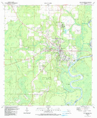
1990 Map of Blountstown
USGS Topo · Published 1990About this map
The Apalachicola River flows along the eastern edge of this panhandle landscape, anchoring the settlement of Blountstown and its river-dependent history. The town center is densely organized around a grid of streets including Juniper Ave and Tupelo Ave, while the surrounding geography is defined by a series of landings and bends such as Neal Landing and West Wynnton Bend. Cultural and community markers are well-distributed across the quadrangle, from the Bethel Ch and Wood Cem to the north, to the modern footprint of the Calhoun Correctional Institution further south.
Find a feature on this map
46 named features on this map. Tap any name to fly to it.
Don’t see what you’re looking for? This feature index may not catch every label — zoom into the map to look around manually.
Map Details
Editions of this 1990 Blountstown Map
This is the sole edition of this map. No revisions or reprints were ever made.
Other maps of this area

1944 · Clarksville
USGS Topo · 1:31,680

1945 · Blountstown
USGS Topo · 1:31,680

1945 · Clarksville
USGS Topo · 1:31,680

1945 · Estiffanulga
USGS Topo · 1:31,680

1945 · Bristol
USGS Topo · 1:31,680

1945 · Frink
USGS Topo · 1:31,680

1945 · Woods
USGS Topo · 1:31,680

1952 · Altha West
USGS Topo · 1:24,000

1952 · Altha East
USGS Topo · 1:24,000

1954 · Tallahassee
USGS Topo · 1:250,000