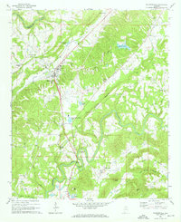
1969 Map of Blountsville
USGS Topo · Published 1972About this map
Blountsville serves as the central hub of this 1969 survey, situated where the Huntsville Meridian transects the winding waterways of Blount County. The landscape is defined by the significant forks of the Black Warrior River system, with the Mulberry Fork cutting through the northwestern corner and the Locust Fork carving deep loops through the south, featuring prominent bends like Blackwood Bend and Stevens Bend.
Find a feature on this map
48 named features on this map. Tap any name to fly to it.
Don’t see what you’re looking for? This feature index may not catch every label — zoom into the map to look around manually.
Map Details
Editions of this 1969 Blountsville Map
4 editions found
Other maps of this area

1885 · Gadsden
USGS Topo · 1:125,000

1888 · Cullman
USGS Topo · 1:125,000

1888 · Gadsden
USGS Topo · 1:125,000

1889 · Springville
USGS Topo · 1:125,000

1889 · Birmingham
USGS Topo · 1:125,000

1892 · Cullman
USGS Topo · 1:125,000

1892 · Birmingham
USGS Topo · 1:125,000

1892 · Springville
USGS Topo · 1:125,000

1892 · Gadsden
USGS Topo · 1:125,000

1895 · Gadsden
USGS Topo · 1:125,000