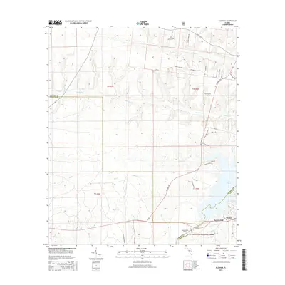
2015 Map of Bloxham
USGS Topo · Published 2015About this map
The waters of Lake Talquin dominate the eastern edge of this Panhandle landscape, where the Ochlockonee River basin meets the sprawling timberlands of the Apalachicola National Forest. The small settlement of Bloxham sits near the base of Jackson Bluff, a prominent terrain feature overlooking the river crossing marked by the Jackson Bluff Bridge. This 2015 survey reveals a complex network of local roads and sandy tracks serving the rural communities and forest acreage, including Pat Thomas Pky and Old Carrabelle Rd. Genealogists and local historians can locate the Friendship Cem in the northern portion of the quadrangle, along with family-named landmarks like Felton Smith. The terrain is defined by a dense drainage system of creeks such as Ocklawaha Cr, Bear Cr, and Hammock Cr that feed into the reservoir and river system.
Find a feature on this map
50 named features on this map. Tap any name to fly to it.
Don’t see what you’re looking for? This feature index may not catch every label — zoom into the map to look around manually.
Map Details
Editions of this 2015 Bloxham Map
This is the sole edition of this map. No revisions or reprints were ever made.
Other maps of this area

1943 · Lake Talquin
USGS Topo · 1:62,500

1945 · Hosford
USGS Topo · 1:31,680

1945 · Telogia
USGS Topo · 1:24,000

1946 · Telogia
USGS Topo · 1:31,680

1954 · Tallahassee
USGS Topo · 1:250,000

1955 · Sycamore
USGS Topo · 1:24,000

1959 · Tallahassee
USGS Topo · 1:250,000

1959 · Gretna
USGS Topo · 1:24,000

1959 · Quincy
USGS Topo · 1:24,000

1960 · Tallahassee
USGS Topo · 1:250,000