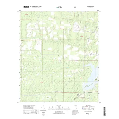
2018 Map of Bloxham
USGS Topo · Published 2018About this map
The Apalachicola National Forest dominates this section of the Florida Panhandle where the Ochlockonee River is harnessed to create the expansive Lake Talquin. The settlement of Bloxham sits at a critical junction near the Jackson Bluff Bridge, marking a landscape defined by the transition from upland ridges to the river's floodplains. Numerous small watercourses, including Ocklawaha Cr, Soupstone Br, and Pittman Creek, carve through the forest, revealing the intricate drainage patterns of Leon, Liberty, and Gadsden counties.
Find a feature on this map
52 named features on this map. Tap any name to fly to it.
Don’t see what you’re looking for? This feature index may not catch every label — zoom into the map to look around manually.
Map Details
Editions of this 2018 Bloxham Map
This is the sole edition of this map. No revisions or reprints were ever made.
Other maps of this area

1943 · Lake Talquin
USGS Topo · 1:62,500

1945 · Hosford
USGS Topo · 1:31,680

1945 · Telogia
USGS Topo · 1:24,000

1946 · Telogia
USGS Topo · 1:31,680

1954 · Tallahassee
USGS Topo · 1:250,000

1955 · Sycamore
USGS Topo · 1:24,000

1959 · Tallahassee
USGS Topo · 1:250,000

1959 · Gretna
USGS Topo · 1:24,000

1959 · Quincy
USGS Topo · 1:24,000

1960 · Tallahassee
USGS Topo · 1:250,000