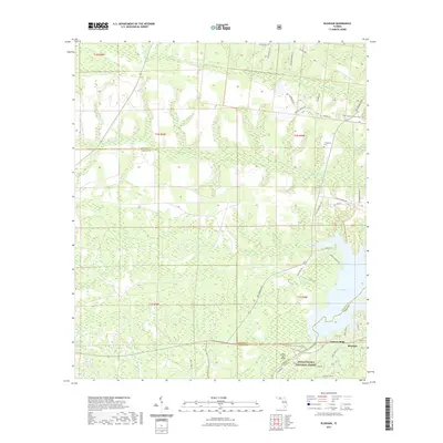
2021 Map of Bloxham
USGS Topo · Published 2021About this map
Lake Talquin dominates the southeastern quadrant of this landscape, its waters shaped by the drainage of the Ochlockonee River and tributaries like Soapstone Br and Hubbard Br. The area around Bloxham reflects a transition from the managed timberlands of the Apalachicola National Forest to the residential and recreational corridors along the reservoir. Notable local landmarks include the Jackson Bluff terrain feature and the associated Jackson Bluff Bridge, which serves as a critical crossing point near the junction of Gadsden, Liberty, and Leon Counties. A network of rural routes, such as Old Ferry Rd and Old Federal Rd, hints at historical transportation patterns that predated modern infrastructure. Local genealogy is anchored by sites like Friendship Cem, while the Lake Talquin State Forest Trl indicates the area's ongoing role in conservation and public recreation.
Find a feature on this map
50 named features on this map. Tap any name to fly to it.
Don’t see what you’re looking for? This feature index may not catch every label — zoom into the map to look around manually.
Map Details
Editions of this 2021 Bloxham Map
This is the sole edition of this map. No revisions or reprints were ever made.
Other maps of this area

1943 · Lake Talquin
USGS Topo · 1:62,500

1945 · Hosford
USGS Topo · 1:31,680

1945 · Telogia
USGS Topo · 1:24,000

1946 · Telogia
USGS Topo · 1:31,680

1954 · Tallahassee
USGS Topo · 1:250,000

1955 · Sycamore
USGS Topo · 1:24,000

1959 · Tallahassee
USGS Topo · 1:250,000

1959 · Gretna
USGS Topo · 1:24,000

1959 · Quincy
USGS Topo · 1:24,000

1960 · Tallahassee
USGS Topo · 1:250,000