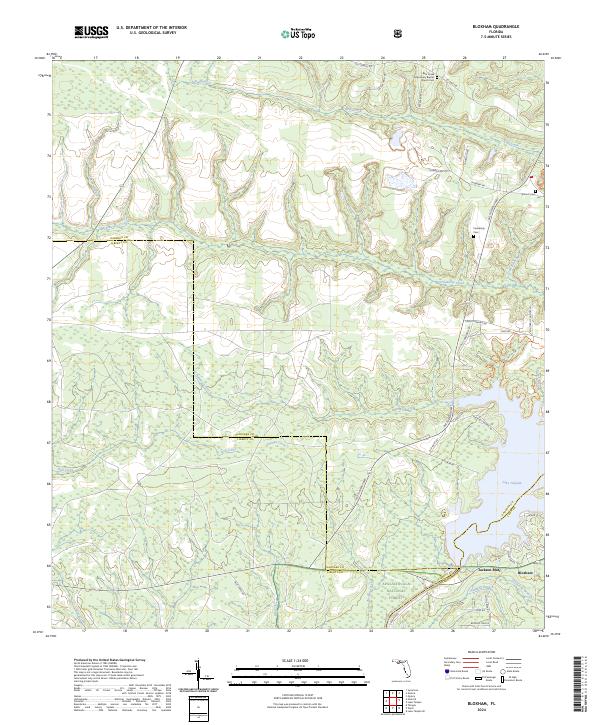
2024 Map of Bloxham
USGS Topo · Published 2024About this map
Jackson Bluff and the small settlement of Bloxham anchor this landscape where Gadsden, Liberty, and Leon counties converge. The terrain is defined by the significant impoundment of Lake Talquin, which dominates the eastern portion of the sheet. To the south, the protected woodland of the Apalachicola National Forest spans the border into Liberty County, while the northern reaches are marked by a dense network of tributaries including Ocklawaha Creek and Bear Creek.
Find a feature on this map
47 named features on this map. Tap any name to fly to it.
Don’t see what you’re looking for? This feature index may not catch every label — zoom into the map to look around manually.
Map Details
Editions of this 2024 Bloxham Map
This is the sole edition of this map. No revisions or reprints were ever made.
Other maps of this area

1943 · Lake Talquin
USGS Topo · 1:62,500

1945 · Hosford
USGS Topo · 1:31,680

1945 · Telogia
USGS Topo · 1:24,000

1946 · Telogia
USGS Topo · 1:31,680

1954 · Tallahassee
USGS Topo · 1:250,000

1955 · Sycamore
USGS Topo · 1:24,000

1959 · Tallahassee
USGS Topo · 1:250,000

1959 · Gretna
USGS Topo · 1:24,000

1959 · Quincy
USGS Topo · 1:24,000

1960 · Tallahassee
USGS Topo · 1:250,000