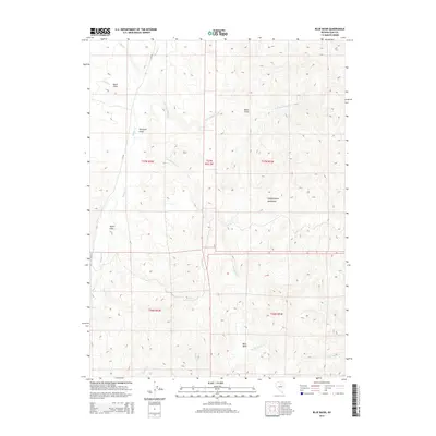
2015 Map of Blue Basin
USGS Topo · Published 2015About this map
Independence Mountains define the high terrain of this Elko County landscape, where the drainage systems of the Great Basin dictate the location of land use and access. The map reveals a series of named agricultural or grazing plots situated along watercourses, such as South Field and Hereford Field bordering Maggie Cr. The network of creeks, including Lone Mountain Cr and Chicken Cr, flow through the sagebrush-covered valleys toward the central Blue Basin. This 2015 survey reflects the contemporary organization of ranching and resource management in Nevada, with isolated landmarks like Basco Field and Taylor Field serving as primary indicators of human activity. The presence of CR-716 provides the main artery through this sparsely populated high-desert region, connecting the various fields and creek basins.
Find a feature on this map
20 named features on this map. Tap any name to fly to it.
Don’t see what you’re looking for? This feature index may not catch every label — zoom into the map to look around manually.
Map Details
Editions of this 2015 Blue Basin Map
This is the sole edition of this map. No revisions or reprints were ever made.
Other maps of this area

1955 · McDermitt
USGS Topo · 1:250,000

1955 · Wells
USGS Topo · 1:250,000

1955 · Winnemucca
USGS Topo · 1:250,000

1955 · Elko
USGS Topo · 1:250,000

1958 · Winnemucca
USGS Topo · 1:250,000

1958 · Wells
USGS Topo · 1:250,000

1958 · Elko
USGS Topo · 1:250,000

1958 · Singletree Creek
USGS Topo · 1:24,000

1958 · Blue Basin
USGS Topo · 1:24,000

1958 · Doby Summit
USGS Topo · 1:24,000