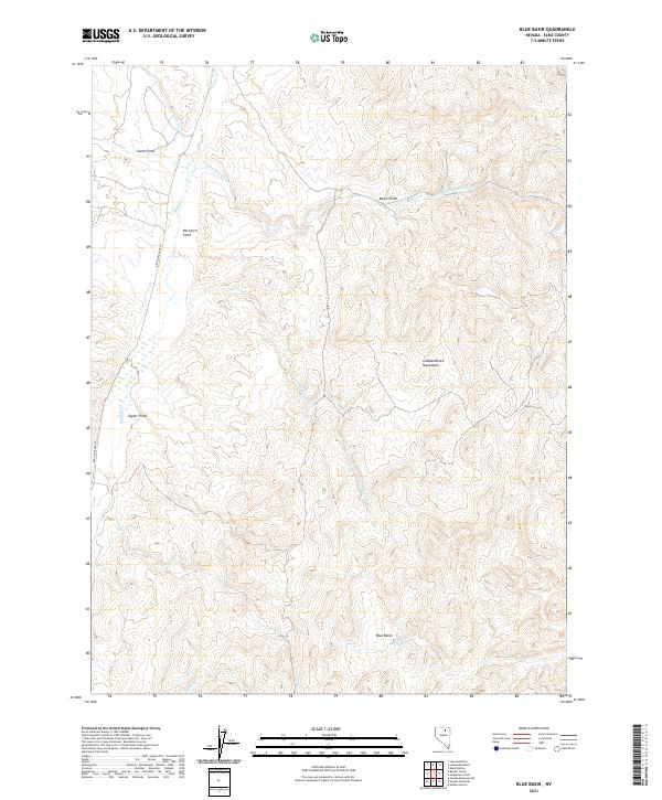
2021 Map of Blue Basin
USGS Topo · Published 2021About this map
The Independence Mountains dominate this Elko County landscape, where high-altitude ranching and drainage networks define the terrain. Modern topographic data from the U.S. Geological Survey reveals a system of named pastures and grazing lands, including Hereford Field, Basco Field, and Taylor Field, situated along the winding course of Maggie Cr. These fields, tied to the Red House Ranch infrastructure, illustrate the organized use of water rights in this arid Nevada basin. The map tracks the headwaters and seasonal flows of numerous tributaries such as Lone Mountain Cr and Chicken Cr, which converge near the eponymous Blue Basin. This detailed record captures the spatial relationship between the rugged upland slopes and the managed agricultural bottomlands at the start of the 2020s.
Find a feature on this map
22 named features on this map. Tap any name to fly to it.
Don’t see what you’re looking for? This feature index may not catch every label — zoom into the map to look around manually.
Map Details
Editions of this 2021 Blue Basin Map
This is the sole edition of this map. No revisions or reprints were ever made.
Other maps of this area

1955 · McDermitt
USGS Topo · 1:250,000

1955 · Wells
USGS Topo · 1:250,000

1955 · Winnemucca
USGS Topo · 1:250,000

1955 · Elko
USGS Topo · 1:250,000

1958 · Winnemucca
USGS Topo · 1:250,000

1958 · Wells
USGS Topo · 1:250,000

1958 · Elko
USGS Topo · 1:250,000

1958 · Singletree Creek
USGS Topo · 1:24,000

1958 · Blue Basin
USGS Topo · 1:24,000

1958 · Doby Summit
USGS Topo · 1:24,000