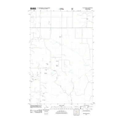
2011 Map of Blue Buttes
USGS Topo · Published 2011About this map
Chimney Butte and Table Butte rise from the McKenzie County landscape, defining a region where cattle ranching and energy extraction share the same soil. In this 2011 depiction, the distribution of industrial landmarks like the Antelope Oil Field and the Blue Buttes Oil and Gas Field indicates the continuing importance of the Williston Basin's resources. The map captures a transition between traditional family landholdings, such as Keogh Ranch and Van Dyke Ranch, and the modern infrastructure required for resource management. Local connectivity is maintained through County Hwy 1806 and BIA Route 27, while the presence of the Redeemer Cemetery and the remote Keogh Landing Strip highlights the sparse but established nature of these rural communities. Water features like Sand Creek and the North Fork Clark Creek wind through the breaks and buttes, providing vital drainage in this semi-arid terrain.
Find a feature on this map
16 named features on this map. Tap any name to fly to it.
Don’t see what you’re looking for? This feature index may not catch every label — zoom into the map to look around manually.
Map Details
Editions of this 2011 Blue Buttes Map
This is the sole edition of this map. No revisions or reprints were ever made.
Other maps of this area

1953 · Williston
USGS Topo · 1:250,000

1953 · Watford City
USGS Topo · 1:250,000

1957 · Williston
USGS Topo · 1:250,000

1957 · Watford City
USGS Topo · 1:250,000

1965 · Keene
USGS Topo · 1:24,000

1965 · Johnsons Corner
USGS Topo · 1:24,000

1965 · Charlson
USGS Topo · 1:24,000

1965 · Blue Buttes
USGS Topo · 1:24,000

1965 · Charlson SW
USGS Topo · 1:24,000

1965 · Blue Buttes SE
USGS Topo · 1:24,000