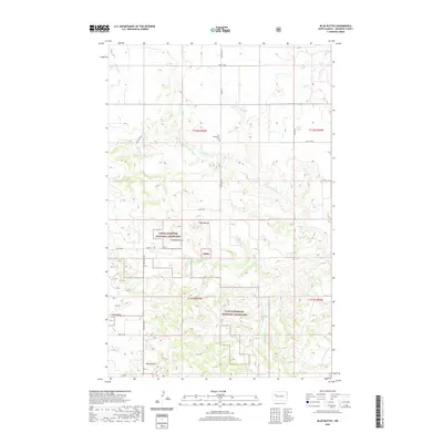
2020 Map of Blue Buttes
USGS Topo · Published 2020About this map
The Little Missouri National Grassland dominates this section of McKenzie County, where the high plains break into a series of distinctive landforms. These natural markers, including Table Butte, Chimney Butte, and Stony Butte, served as essential waypoints in an otherwise open landscape. The Blue Buttes rise in the southern portion of the map, overlooking the drainage basins of N Fork Clark Cr and Clarks Cr. The land is organized by a strict grid of section lines and rural routes like Co Rte 12 and 104th Ave NW, reflecting the late-era township and range system. Human presence is concentrated around isolated markers of community life, most notably the Our Redeemer Cem, which stands as a quiet focal point for local family histories within this expansive grassland territory.
Find a feature on this map
22 named features on this map. Tap any name to fly to it.
Don’t see what you’re looking for? This feature index may not catch every label — zoom into the map to look around manually.
Map Details
Editions of this 2020 Blue Buttes Map
This is the sole edition of this map. No revisions or reprints were ever made.
Other maps of this area

1953 · Williston
USGS Topo · 1:250,000

1953 · Watford City
USGS Topo · 1:250,000

1957 · Williston
USGS Topo · 1:250,000

1957 · Watford City
USGS Topo · 1:250,000

1965 · Keene
USGS Topo · 1:24,000

1965 · Johnsons Corner
USGS Topo · 1:24,000

1965 · Charlson
USGS Topo · 1:24,000

1965 · Blue Buttes
USGS Topo · 1:24,000

1965 · Charlson SW
USGS Topo · 1:24,000

1965 · Blue Buttes SE
USGS Topo · 1:24,000