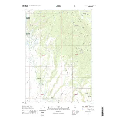
2020 Map of Blue Creek Reservoir
USGS Topo · Published 2020About this map
The Sand Creek Elk Refuge and Targhee National Forest dominate this High Desert landscape, defined by volcanic geology and vital water management systems. The map covers a significant portion of the Island Park Caldera and Henrys Fork Caldera, showcasing the unique topography of Big Bend Ridge. A network of water resources, including Blue Cr Reservoir, Sand Creek Reservoir, and the Mikesell Reservoir Number One, supports the local ecosystem and suggests the critical role of irrigation and wildlife management in this corner of Fremont County.
Find a feature on this map
52 named features on this map. Tap any name to fly to it.
Don’t see what you’re looking for? This feature index may not catch every label — zoom into the map to look around manually.
Map Details
Editions of this 2020 Blue Creek Reservoir Map
This is the sole edition of this map. No revisions or reprints were ever made.
Other maps of this area

1955 · Ashton
USGS Topo · 1:250,000

1958 · Ashton
USGS Topo · 1:250,000

1960 · Ashton
USGS Topo · 1:250,000

1964 · Last Chance
USGS Topo · 1:24,000
1965 · Black Knoll
USGS Topo · 1:24,000

1965 · Lemon Lake
USGS Topo · 1:24,000
1965 · Split Butte
USGS Topo · 1:24,000

1965 · Ashton
USGS Topo · 1:24,000

1965 · Lookout Butte
USGS Topo · 1:24,000

1965 · Blue Creek Reservoir
USGS Topo · 1:24,000