
1965 Map of Blue Creek Reservoir
USGS Topo · Published 1967About this map
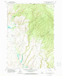
Big Bend Ridge dominates the eastern half of this terrain in Fremont County, where the highlands of the Targhee National Forest transition into a complex system of water management. The 1965 field survey shows a landscape defined by its reliance on springs and reservoirs, with irrigation and livestock needs evidenced by the Upper Arcadia Reservoir, Lower Arcadia Reservoir, and the dual Mikesell Reservoir No 1 and Mikesell Res No 2. Numerous named water sources, such as Jackson Mill Spring and Fogg Millsite Well, suggest a history of localized resource use in this high-altitude environment. A network of jeep trails and the High Point Road provide the primary access through the canyons, including Sadorus Canyon and De Witt Canyon, which cut through the western slopes toward the Sand Creek drainage.
Find a feature on this map
37 named features on this map. Tap any name to fly to it.
Don’t see what you’re looking for? This feature index may not catch every label — zoom into the map to look around manually.
Map Details
Editions of this 1965 Blue Creek Reservoir Map
2 editions found
Other maps of this area

1955 · Ashton
USGS Topo · 1:250,000

1958 · Ashton
USGS Topo · 1:250,000

1960 · Ashton
USGS Topo · 1:250,000

1964 · Last Chance
USGS Topo · 1:24,000
1965 · Black Knoll
USGS Topo · 1:24,000

1965 · Lemon Lake
USGS Topo · 1:24,000
1965 · Split Butte
USGS Topo · 1:24,000

1965 · Ashton
USGS Topo · 1:24,000

1965 · Lookout Butte
USGS Topo · 1:24,000

1965 · Crystal Butte
USGS Topo · 1:24,000