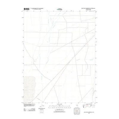
2012 Map of Blue Eagle Springs NE
USGS Topo · Published 2012About this map
Duckwater Creek meanders through this portion of Nye County, defining a drainage pattern that characterizes the high desert landscape of central Nevada. The map details a network of seasonal watercourses, including Kern Creek, Currant Creek, and Bull Creek, which descend from the surrounding highlands into the arid basin. These hydrologic features, alongside the prominent The Big Wash in the eastern section, illustrate the natural water management of the region before any major modern diversions. Transportation in this era is represented by R R Valley Rd, a primary route through the valley floor that connects the scattered natural springs and grazing lands. The sparse development shown here reflects the enduring rural character of the Great Basin, where land use remains closely tied to the availability of water from these specific named creeks and washes.
Find a feature on this map
6 named features on this map. Tap any name to fly to it.
Don’t see what you’re looking for? This feature index may not catch every label — zoom into the map to look around manually.
Map Details
Editions of this 2012 Blue Eagle Springs NE Map
This is the sole edition of this map. No revisions or reprints were ever made.
Other maps of this area

1956 · Lund
USGS Topo · 1:250,000

1957 · Currant Mtn
USGS Topo · 1:62,500

1960 · Lund
USGS Topo · 1:250,000

1964 · Blue Eagle Springs
USGS Topo · 1:62,500

1964 · Duckwater
USGS Topo · 1:62,500

1964 · Currant
USGS Topo · 1:62,500

1964 · Currant Mtn
USGS Topo · 1:62,500

1980 · Duckwater
USGS Topo · 1:100,000
1990 · Bradshaw Spring
USGS Topo · 1:24,000
1990 · Currant
USGS Topo · 1:24,000