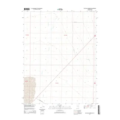
2014 Map of Blue Eagle Springs NE
USGS Topo · Published 2014About this map
Duckwater Cr and Currant Cr define the drainage patterns of this high-desert landscape in Nye County, flowing through a region partitioned by the Public Land Survey System. The map illustrates a transition from the alluvial fans of the mountains into the broad basin of the south, where Railroad Valley Rd serves as a primary transit corridor. While largely unpopulated, the infrastructure of the area is marked by Firestation Rd and the presence of Bull-Er and Kern Cr in the northern reaches. The vast, open character of the terrain is further evidenced by The Big Wash in the east, highlighting the seasonal watercourses that have shaped the local geography. This survey provides an essential view of the hydrological and transportation network within the Great Basin's interior.
Find a feature on this map
13 named features on this map. Tap any name to fly to it.
Don’t see what you’re looking for? This feature index may not catch every label — zoom into the map to look around manually.
Map Details
Editions of this 2014 Blue Eagle Springs NE Map
This is the sole edition of this map. No revisions or reprints were ever made.
Other maps of this area

1956 · Lund
USGS Topo · 1:250,000

1957 · Currant Mtn
USGS Topo · 1:62,500

1960 · Lund
USGS Topo · 1:250,000

1964 · Blue Eagle Springs
USGS Topo · 1:62,500

1964 · Duckwater
USGS Topo · 1:62,500

1964 · Currant
USGS Topo · 1:62,500

1964 · Currant Mtn
USGS Topo · 1:62,500

1980 · Duckwater
USGS Topo · 1:100,000
1990 · Bradshaw Spring
USGS Topo · 1:24,000
1990 · Currant
USGS Topo · 1:24,000