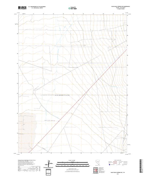
2021 Map of Blue Eagle Springs NE
USGS Topo · Published 2021About this map
Railroad Valley dominates this high-desert landscape in Nye County, showing a sparse network of watercourses and roads that define the region's geography. The map traces the paths of several seasonal streams, including Duckwater Cr and Currant Cr, which flow toward the central basin. These ephemeral waterways, along with Kern Cr and Bull Cr, illustrate the drainage patterns typical of the Great Basin's endorheic systems.
Find a feature on this map
13 named features on this map. Tap any name to fly to it.
Don’t see what you’re looking for? This feature index may not catch every label — zoom into the map to look around manually.
Map Details
Editions of this 2021 Blue Eagle Springs NE Map
This is the sole edition of this map. No revisions or reprints were ever made.
Other maps of this area

1956 · Lund
USGS Topo · 1:250,000

1957 · Currant Mtn
USGS Topo · 1:62,500

1960 · Lund
USGS Topo · 1:250,000

1964 · Blue Eagle Springs
USGS Topo · 1:62,500

1964 · Duckwater
USGS Topo · 1:62,500

1964 · Currant
USGS Topo · 1:62,500

1964 · Currant Mtn
USGS Topo · 1:62,500

1980 · Duckwater
USGS Topo · 1:100,000
1990 · Bradshaw Spring
USGS Topo · 1:24,000
1990 · Currant
USGS Topo · 1:24,000