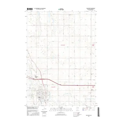
2016 Map of Blue Earth
USGS Topo · Published 2016About this map
The Blue Earth River and its East Branch converge south of the city of Blue Earth, creating a landscape defined by water and highly organized agriculture. The grid-based settlement of the city is buffered by Riverside Heights and Riverside, while the surrounding prairie is divided into precise sections by an extensive network of range and township lines. Agricultural management is evident through the presence of engineered waterways like County Ditch Number Seventeen and County Ditch Number Fourteen, which supplement natural streams such as Rice Cr. Local heritage is anchored by several burial grounds situated on the outskirts of the town center, including Calvary Cem to the north and both the Immanuel United Methodist Cem and King Cem located to the east, offering specific points of interest for genealogical research.
Find a feature on this map
66 named features on this map. Tap any name to fly to it.
Don’t see what you’re looking for? This feature index may not catch every label — zoom into the map to look around manually.
Map Details
Editions of this 2016 Blue Earth Map
This is the sole edition of this map. No revisions or reprints were ever made.
Other maps of this area

1954 · Fairmont
USGS Topo · 1:250,000

1954 · Mason City
USGS Topo · 1:250,000

1955 · Bricelyn
USGS Topo · 1:62,500

1957 · Mason City
USGS Topo · 1:250,000

1958 · Mason City
USGS Topo · 1:250,000

1958 · Fairmont
USGS Topo · 1:250,000

1967 · Pilot Grove
USGS Topo · 1:24,000

1967 · Winnebago
USGS Topo · 1:24,000

1967 · Elmore
USGS Topo · 1:24,000

1967 · Huntley
USGS Topo · 1:24,000