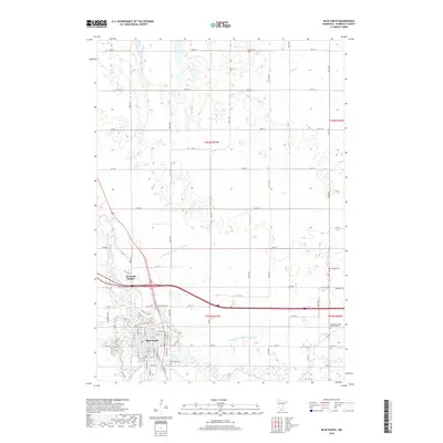
2019 Map of Blue Earth
USGS Topo · Published 2019About this map
The Blue Earth River and its East Branch converge south of the city of Blue Earth, creating a landscape defined by natural waterways and an extensive network of drainage infrastructure like County Ditch Number Seventeen and County Ditch Number Fourteen. This 2019 survey documents the modern layout of the city, including its residential expansion into Riverside Heights and the industrial and municipal sectors near the junction of major transit routes. The map is a vital resource for genealogists, as it meticulously identifies several local burial sites, such as Riverside Cem and Calvary Cem north of town. Rural church history is preserved through labels like Immanuel Ch, while the surrounding sections illustrate the grid of agricultural roads that have partitioned Faribault County since its early development.
Find a feature on this map
54 named features on this map. Tap any name to fly to it.
Don’t see what you’re looking for? This feature index may not catch every label — zoom into the map to look around manually.
Map Details
Editions of this 2019 Blue Earth Map
This is the sole edition of this map. No revisions or reprints were ever made.
Other maps of this area

1954 · Fairmont
USGS Topo · 1:250,000

1954 · Mason City
USGS Topo · 1:250,000

1955 · Bricelyn
USGS Topo · 1:62,500

1957 · Mason City
USGS Topo · 1:250,000

1958 · Mason City
USGS Topo · 1:250,000

1958 · Fairmont
USGS Topo · 1:250,000

1967 · Pilot Grove
USGS Topo · 1:24,000

1967 · Winnebago
USGS Topo · 1:24,000

1967 · Elmore
USGS Topo · 1:24,000

1967 · Huntley
USGS Topo · 1:24,000