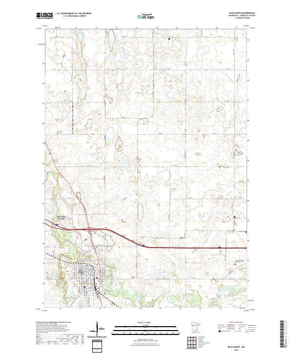
2022 Map of Blue Earth
USGS Topo · Published 2022About this map
Blue Earth serves as the focal point of this Faribault County landscape, situated at the confluence where the Blue Earth River meets its tributaries. The town's civic heart is anchored by the Faribault County Courthouse, while the surrounding prairie is defined by a sophisticated water management system including County Ditch Number Seventeen and County Ditch Number Fourteen. For those researching family history, the map identifies several distinct burial grounds scattered across the townships, from the centrally located Riverside Cem to more outlying sites like King Cem, Calvary Cem, and the Immanuel United Methodist Cem. North of the main settlement, Riverside Heights sits near the winding river banks, illustrating the modern residential expansion alongside the natural drainage of Rice Cr.
Find a feature on this map
51 named features on this map. Tap any name to fly to it.
Don’t see what you’re looking for? This feature index may not catch every label — zoom into the map to look around manually.
Map Details
Editions of this 2022 Blue Earth Map
This is the sole edition of this map. No revisions or reprints were ever made.
Other maps of this area

1954 · Fairmont
USGS Topo · 1:250,000

1954 · Mason City
USGS Topo · 1:250,000

1955 · Bricelyn
USGS Topo · 1:62,500

1957 · Mason City
USGS Topo · 1:250,000

1958 · Mason City
USGS Topo · 1:250,000

1958 · Fairmont
USGS Topo · 1:250,000

1967 · Pilot Grove
USGS Topo · 1:24,000

1967 · Winnebago
USGS Topo · 1:24,000

1967 · Elmore
USGS Topo · 1:24,000

1967 · Huntley
USGS Topo · 1:24,000