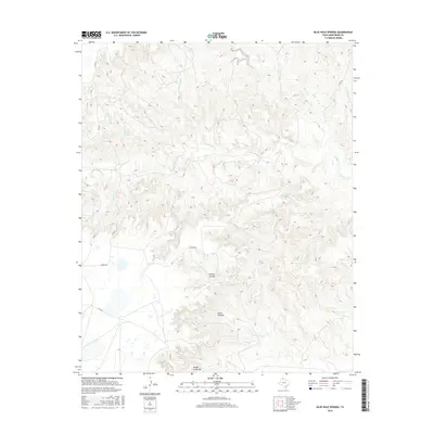
2016 Map of Blue Hole Springs
USGS Topo · Published 2016About this map
Blue Hole Springs and its namesake drainage, Blue Hole Cr, anchor this survey of the northern Texas Panhandle. The landscape is defined by the complex branching of Mulberry Cr and its many tributaries, including Parker Cr and Deadwood Cr, which have carved deep into the regional plateau. While the northern half of the area is dominated by this intricate drainage network, the southern portion features dramatic landforms such as Dutch Canyon and the Koogle Jump-Off. Cultural features are sparse in this rural Armstrong County territory, consisting primarily of a few isolated routes like Romeo Rd and Co Rd 25 that navigate the high ground between the arroyos. The map highlights the contrast between the flat high plains and the sudden verticality of the Willow Arroyo system, illustrating the ongoing erosional processes of the High Plains escarpment.
Find a feature on this map
18 named features on this map. Tap any name to fly to it.
Don’t see what you’re looking for? This feature index may not catch every label — zoom into the map to look around manually.
Map Details
Editions of this 2016 Blue Hole Springs Map
This is the sole edition of this map. No revisions or reprints were ever made.
Other maps of this area

1954 · Amarillo
USGS Topo · 1:250,000

1954 · Plainview
USGS Topo · 1:250,000

1958 · Amarillo
USGS Topo · 1:250,000

1958 · Plainview
USGS Topo · 1:250,000

1960 · Claude
USGS Topo · 1:62,500

1960 · Groom
USGS Topo · 1:62,500

1963 · Blue Hole Springs
USGS Topo · 1:24,000

1963 · Buffalo Arroyo
USGS Topo · 1:24,000

1963 · Luttrell Springs NE
USGS Topo · 1:24,000

1963 · Paloduro
USGS Topo · 1:24,000