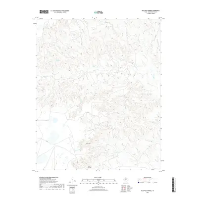
2019 Map of Blue Hole Springs
USGS Topo · Published 2019About this map
Blue Hole Springs serves as a primary hydrological focal point in this portion of Armstrong County, where the High Plains drop into the deeply dissected canyonlands of the Texas Panhandle. The landscape is defined by an intricate network of drainages including Mulberry Cr, Pearlwood Cr, and Parker Cr, which carve through the caprock to create distinctive topographic features. The dramatic transition from level plateau to jagged escarpment is most evident at the Koogle Jump-Off, a steep break in the terrain near Koogle Cr. Further south, Dutch Canyon and Cottonwood Cr illustrate the erosion patterns characteristic of the region's draws and arroyos, such as Willow Arroyo. Sparse infrastructure like Romeo Rd and Co RD 25 provide the only modern access through this complex system of breaks and watercourses.
Find a feature on this map
18 named features on this map. Tap any name to fly to it.
Don’t see what you’re looking for? This feature index may not catch every label — zoom into the map to look around manually.
Map Details
Editions of this 2019 Blue Hole Springs Map
This is the sole edition of this map. No revisions or reprints were ever made.
Other maps of this area

1954 · Amarillo
USGS Topo · 1:250,000

1954 · Plainview
USGS Topo · 1:250,000

1958 · Amarillo
USGS Topo · 1:250,000

1958 · Plainview
USGS Topo · 1:250,000

1960 · Claude
USGS Topo · 1:62,500

1960 · Groom
USGS Topo · 1:62,500

1963 · Blue Hole Springs
USGS Topo · 1:24,000

1963 · Buffalo Arroyo
USGS Topo · 1:24,000

1963 · Luttrell Springs NE
USGS Topo · 1:24,000

1963 · Paloduro
USGS Topo · 1:24,000