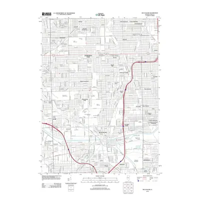
2012 Map of Blue Island
USGS Topo · Published 2012About this map
The suburban and residential grid of South Side Chicago and its neighbors is remarkably dense on this sheet, characterized by a massive concentration of large-scale cemeteries. Significant tracts of land are dedicated to Oak Hill Cemetery, Mount Greenwood Cem, and Saint Casimir Lithuanian Cem, creating a vast greenbelt that separates the municipal blocks of Evergreen Park and Mount Greenwood. The landscape is physically divided by the Calumet-Sag-Channel and the Little Calumet River, which define the lower industrial and recreational corridors. Cultural and academic anchors like Saint Xavier University and the Metropolitan Business College appear alongside unique neighborhood names like Dummy Junction and The Crossing. The area reflects a complex urban development pattern where transit-oriented settlements like Beverly Hills and Morgan Park evolved into the established neighborhoods of the modern era.
Find a feature on this map
160 named features on this map. Tap any name to fly to it.
Don’t see what you’re looking for? This feature index may not catch every label — zoom into the map to look around manually.
Map Details
Editions of this 2012 Blue Island Map
This is the sole edition of this map. No revisions or reprints were ever made.
Other maps of this area

1889 · Chicago
USGS Topo · 1:62,500

1890 · Des Plaines
USGS Topo · 1:62,500

1891 · Chicago
USGS Topo · 1:62,500

1891 · Riverside
USGS Topo · 1:62,500

1892 · Calumet
USGS Topo · 1:62,500

1893 · Calumet
USGS Topo · 1:62,500

1893 · Riverside
USGS Topo · 1:62,500

1894 · Des Plaines
USGS Topo · 1:62,500

1900 · Chicago
USGS Topo · 1:62,500

1900 · Des Plaines
USGS Topo · 1:62,500