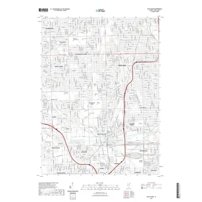
2021 Map of Blue Island
USGS Topo · Published 2021About this map
The Calumet-Sag Channel cuts a deep industrial and hydrological line through this southern Cook County landscape, anchoring a complex network of rail and residential growth. This 2021 survey illustrates the dense urban interface of Chicago's southern reaches, including the historic ridge at Blue Island-Ridge. The area is notably dense with commemorative and religious sites, such as Saint Mary Catholic Cem and Mausoleums and Mount Greenwood Cem, which serve as significant genealogical landmarks for regional families. Educational and community institutions like Saint Xavier University and Moraine Valley Community College are established within the grid of residential streets. South of the channel, the landscape transitions toward the open space of Kickapoo Meadows and the winding course of Midlothian Cr, reflecting the varied land use between the heavy infrastructure of Riverdale and the residential blocks of Oak Lawn.
Find a feature on this map
153 named features on this map. Tap any name to fly to it.
Don’t see what you’re looking for? This feature index may not catch every label — zoom into the map to look around manually.
Map Details
Editions of this 2021 Blue Island Map
This is the sole edition of this map. No revisions or reprints were ever made.
Other maps of this area

1889 · Chicago
USGS Topo · 1:62,500

1890 · Des Plaines
USGS Topo · 1:62,500

1891 · Chicago
USGS Topo · 1:62,500

1891 · Riverside
USGS Topo · 1:62,500

1892 · Calumet
USGS Topo · 1:62,500

1893 · Calumet
USGS Topo · 1:62,500

1893 · Riverside
USGS Topo · 1:62,500

1894 · Des Plaines
USGS Topo · 1:62,500

1900 · Chicago
USGS Topo · 1:62,500

1900 · Des Plaines
USGS Topo · 1:62,500