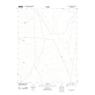
2012 Map of Blue Jay Spring
USGS Topo · Published 2012About this map
Hot Creek Valley dominates this high-desert landscape in central Nevada, characterized by its complex drainage network and vital water sources. This area is defined by its deep drainages, including Old Dominion Canyon and Keystone Canyon, which funnel seasonal waters toward the central basin. The naming of Key 5 Tone Ruins Rd suggests historical remnants in the vicinity, while established tracks like 9 Mile Rd and Hot Creek Rd provide the primary access through the arid terrain. Natural springs serve as critical points of interest for those tracking historical land use, with Blue Jay Spring, Hot Creek Valley Spring, and Butte Spring indicating the scarce but essential water supply that supported movement and settlement in this corner of Nye County. The map also traces the winding course of Moores Station Wash and Tybo Creek, which illustrate the hydrological patterns of the Great Basin.
Find a feature on this map
14 named features on this map. Tap any name to fly to it.
Don’t see what you’re looking for? This feature index may not catch every label — zoom into the map to look around manually.
Map Details
Editions of this 2012 Blue Jay Spring Map
This is the sole edition of this map. No revisions or reprints were ever made.
Other maps of this area

1956 · Tonopah
USGS Topo · 1:250,000

1959 · Tonopah
USGS Topo · 1:250,000

1962 · Tonopah
USGS Topo · 1:250,000

1967 · Lunar Crater
USGS Topo · 1:62,500

1967 · Moores Station
USGS Topo · 1:62,500

1967 · Blue Jay Spring
USGS Topo · 1:24,000

1967 · Buckwheat Rim
USGS Topo · 1:24,000

1967 · Palisade Mesa
USGS Topo · 1:24,000

1967 · Tybo SE
USGS Topo · 1:24,000
1967 · Moores Station SW
USGS Topo · 1:24,000