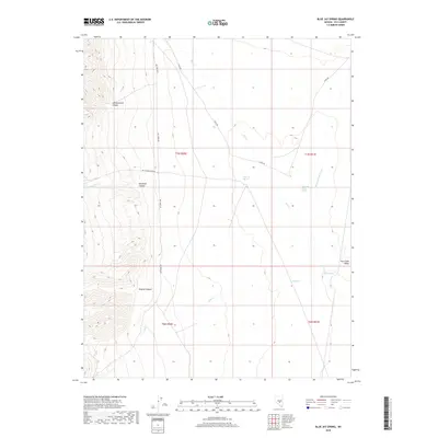
2018 Map of Blue Jay Spring
USGS Topo · Published 2018About this map
Hot Creek Valley dominates the eastern half of this terrain, where a series of water sources including Blue Jay Spring, Hot Creek Valley Spring, and Butte Spring emerge from the arid floor. To the west, the landscape rises sharply into high ridges dissected by Old Dominion Canyon, Keystone Canyon, and Empire Canyon. This topography reflects the typical Great Basin character, where seasonal drainages like Moores Station Wash and Tybo Cr provide intermittent relief to the valley below. The presence of Key S Tone Ruins Rd and Hot Creek Rd indicates a history of back-country access and potential early settlement or mining sites tucked into the canyon mouths, where Shoshone Cr flows out from the mountain front.
Find a feature on this map
18 named features on this map. Tap any name to fly to it.
Don’t see what you’re looking for? This feature index may not catch every label — zoom into the map to look around manually.
Map Details
Editions of this 2018 Blue Jay Spring Map
This is the sole edition of this map. No revisions or reprints were ever made.
Other maps of this area

1956 · Tonopah
USGS Topo · 1:250,000

1959 · Tonopah
USGS Topo · 1:250,000

1962 · Tonopah
USGS Topo · 1:250,000

1967 · Lunar Crater
USGS Topo · 1:62,500

1967 · Moores Station
USGS Topo · 1:62,500

1967 · Blue Jay Spring
USGS Topo · 1:24,000

1967 · Buckwheat Rim
USGS Topo · 1:24,000

1967 · Palisade Mesa
USGS Topo · 1:24,000

1967 · Tybo SE
USGS Topo · 1:24,000
1967 · Moores Station SW
USGS Topo · 1:24,000