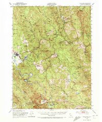
1951 Map of Blue Lake
USGS Topo · Published 1972About this map
Blue Lake and Korbel anchor the western edge of this coastal range landscape, where the Mad River winds through narrow valleys and timbered ridges. The map reflects a mid-century period of interior Humboldt County development, showing the City of Eureka Reservoir and the Swersey Dam Spillway as critical infrastructure for the growing region. Further east, the terrain rises toward Berry Summit and Lord Ellis Summit, dominated by the expanse of the Six Rivers National Forest. This survey is particularly valuable for its documentation of family-named ranching and homestead sites that defined the local economy, including Butler Valley Ranch, Angel Ranch, and the McElahan Cabin. These remote outposts are connected by a network of prairies and ridges, such as Boynton Prairie and Dunn Ridge, illustrating the historical reliance on elevated meadows for grazing and travel above the densely wooded canyons of Redwood Creek.
Find a feature on this map
77 named features on this map. Tap any name to fly to it.
Don’t see what you’re looking for? This feature index may not catch every label — zoom into the map to look around manually.
Map Details
Editions of this 1951 Blue Lake Map
5 editions found

Other maps of this area

1914 · Pilot Creek
USGS Topo · 1:62,500

1915 · Big Bar and Vicinity
USGS Topo · 1:250,000

1922 · Eureka
USGS Topo · 1:62,500

1922 · Korbel
USGS Topo · 1:62,500

1922 · China Flat
USGS Topo · 1:62,500

1922 · Kneeland
USGS Topo · 1:62,500

1925 · Hoopa
USGS Topo · 1:125,000

1933 · Eureka
USGS Topo · 1:48,000

1942 · Eureka
USGS Topo · 1:62,500

1944 · Fortuna
USGS Topo · 1:62,500