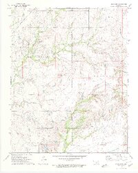
1972 Map of Blue Mound
USGS Topo · Published 1974About this map
Blue Mound rises as a prominent landmark over the landscape of northern Oklahoma in the early 1970s. The region is defined by its industrial activity, marked by an extensive Oil Field and numerous Oil Wells, particularly in the eastern sections of Lenapah and Nowata. The Missouri-Kansas-Texas railroad cuts through the northwestern corner, following the path of Coon Creek and Cedar Creek. A complex network of infrastructure, including a prominent Pipeline and scattered Drill Holes, indicates the intensity of resource extraction. Local drainage is defined by named waterways such as Little California Creek and the deep Houshooter Draw, which move through a terrain also marked by various Gravel Pits and a Shale Pit.
Find a feature on this map
25 named features on this map. Tap any name to fly to it.
Don’t see what you’re looking for? This feature index may not catch every label — zoom into the map to look around manually.
Map Details
Editions of this 1972 Blue Mound Map
2 editions found
Other maps of this area

1901 · Nowata
USGS Topo · 1:125,000

1914 · Nowata
USGS Topo · 1:125,000

1954 · Tulsa
USGS Topo · 1:250,000

1958 · Tulsa
USGS Topo · 1:250,000

1963 · Tulsa
USGS Topo · 1:250,000
1971 · Bartlesville South
USGS Topo · 1:24,000
1971 · Bartlesville North
USGS Topo · 1:24,000

1972 · Blue Mound
USGS Topo · 1:24,000
1972 · Elliott
USGS Topo · 1:24,000

1972 · Nowata West
USGS Topo · 1:24,000