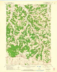
1962 Map of Blue Mounds
USGS Topo · Published 1964About this map
The highest point in southern Wisconsin towers over the surrounding driftless area, where the Blue Mounds dominate the landscape. In the early 1960s, this region shows a transition from agricultural valley life to recreational and historical tourism. The village of Blue Mounds sits near the base of the mounds, adjacent to the southern rail line of the Chicago and North Western railroad. Nearby, the presence of Little Norway and the Cave of the Mounds marks the area as a destination for geological and cultural exploration.
Find a feature on this map
27 named features on this map. Tap any name to fly to it.
Don’t see what you’re looking for? This feature index may not catch every label — zoom into the map to look around manually.
Map Details
Editions of this 1962 Blue Mounds Map
3 editions found
Other maps of this area

1907 · Cross Plains
USGS Topo · 1:62,500

1909 · Cross Plains
USGS Topo · 1:62,500

1920 · Blue Mounds
USGS Topo · 1:62,500

1922 · Blue Mounds
USGS Topo · 1:62,500

1923 · Blanchardville
USGS Topo · 1:62,500

1923 · New Glarus
USGS Topo · 1:62,500

1954 · Rockford
USGS Topo · 1:250,000

1955 · Rockford
USGS Topo · 1:250,000

1957 · Madison
USGS Topo · 1:250,000

1958 · Rockford
USGS Topo · 1:250,000