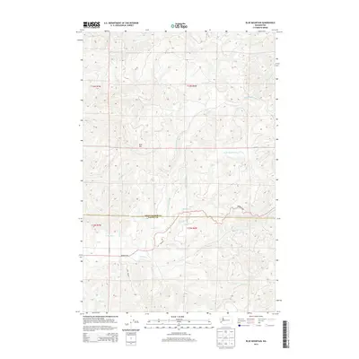
2014 Map of Blue Mountain
USGS Topo · Published 2014About this map
Blue Mtn stands as a prominent topographical feature in this forested interior of Washington, where the high ridges of Grays Harbor Co and Pacific Co meet. The landscape is defined by an intricate network of drainages, including the North River and its numerous tributaries such as Raimie Cr, Redfield Cr, and Wheeler Cr. This 2014 survey reveals a rugged geography managed for timber, with a road network consisting of routes like Brooklyn Rd and Oakville Rd that navigate the winding valley floors and steep elevations. Traces of industrial influence appear in labels like Port Blakely, indicating the area's ongoing history with large-scale land management. This map provides a detailed view of the watershed and logging infrastructure at a time when these backroads remained essential for connectivity between the small communities of the Pacific Northwest hinterlands.
Find a feature on this map
27 named features on this map. Tap any name to fly to it.
Don’t see what you’re looking for? This feature index may not catch every label — zoom into the map to look around manually.
Map Details
Editions of this 2014 Blue Mountain Map
This is the sole edition of this map. No revisions or reprints were ever made.
Other maps of this area

1940 · Montesano
USGS Topo · 1:62,500

1941 · Walville
USGS Topo · 1:62,500

1941 · Ford
USGS Topo · 1:62,500

1953 · Hoquiam
USGS Topo · 1:250,000

1953 · Pe Ell
USGS Topo · 1:62,500

1953 · Malone
USGS Topo · 1:62,500

1955 · Montesano
USGS Topo · 1:62,500

1955 · Raymond
USGS Topo · 1:62,500

1957 · Hoquiam
USGS Topo · 1:250,000

1958 · Hoquiam
USGS Topo · 1:250,000