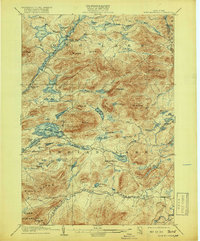
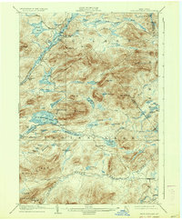
1903 Map of Blue Mountain
USGS Topo · Published 1942About this map
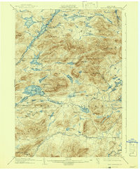
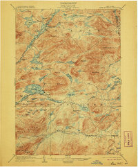
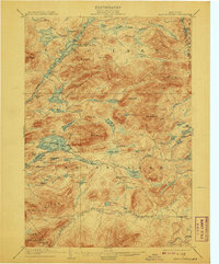
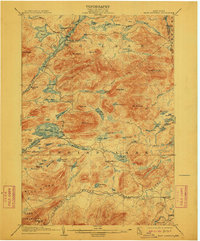
The Steamboat Route winding through Long Lake and the Raquette River defines the transport network of this central Adirondack wilderness at the turn of the century. Surveyed between 1899 and 1900, the map illustrates a landscape of major water bodies and early settlements like Blue Mountain Lake and Indian Lake. Notable landmarks such as the Forest House and Tewahloondah suggest the era's growing hospitality and estate culture, while features like Rolling Dam on the Rock River and various marshes like Thirtyfour Marsh point to the region's logging and hydraulic history. The detailed topography centers on the 3,759-foot peak of Blue Mt. and surrounding heights like Buck Mt. and Mt. Sabattis. This document records the complex network of ponds and river flows, from Utowana Lake to the Cedar River, before later development altered many of these backcountry routes.
Find a feature on this map
75 named features on this map. Tap any name to fly to it.
Don’t see what you’re looking for? This feature index may not catch every label — zoom into the map to look around manually.
Map Details
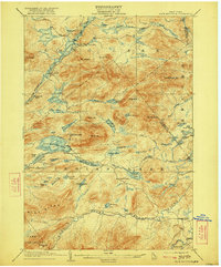
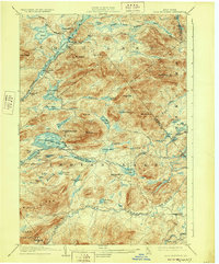
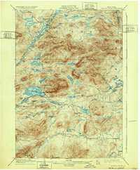
Editions of this 1903 Blue Mountain Map
11 editions found

1903 edition
16.6 x 20.1 inches
1906 edition
16.6 x 20 inches
1908 edition
16.6 x 20.1 inches
1912 edition
16.6 x 20.1 inches
1919 edition
16.6 x 20.1 inches
1922 edition
16.6 x 20 inches
1928 edition
16.6 x 20.1 inches
1932 edition
16.6 x 20.1 inches
1937 edition
16.6 x 20.1 inches
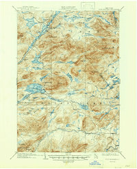
1942 edition
16.6 x 20.2 inches
1947 edition
17 x 20.9 inches
Other maps of this area

1898 · Newcomb
USGS Topo · 1:62,500

1898 · Thirteenth Lake
USGS Topo · 1:62,500

1899 · Indian Lake
USGS Topo · 1:62,500

1900 · Canada Lake
USGS Topo · 1:62,500

1901 · Newcomb
USGS Topo · 1:62,500

1902 · Indian Lake
USGS Topo · 1:62,500

1903 · West Canada Lakes
USGS Topo · 1:62,500

1903 · Raquette Lake
USGS Topo · 1:62,500
1903 · Blue Mountain
USGS Topo · 1:62,500

1904 · Santanoni
USGS Topo · 1:62,500