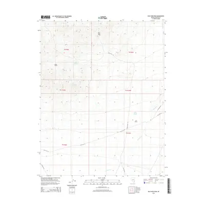
2014 Map of Blue Nose Peak
USGS Topo · Published 2014About this map
Blue Nose Peak rises as the central landmark in this high desert landscape of southeastern Lincoln County. This 2014 survey documents a network of arid water management and remote transit routes through the Tule Desert, where vital water sources like Dodge Pocket Reservoir, White Rock Reservoir, and the descriptively named End of the Line Trough indicate the region's reliance on scattered catchments. The terrain is defined by natural drainage patterns like Garden Wash and geological formations such as Dodge Pockets. A series of back-country roads, including Snow Spring Rd and Tule Spring Rd, connect these remote basins, reflecting the persistent footprint of ranching and land management in the Great Basin. This edition provides a precise inventory of these named peaks and desert hollows, essential for understanding the modern topography and historical usage of the Nevada interior.
Find a feature on this map
19 named features on this map. Tap any name to fly to it.
Don’t see what you’re looking for? This feature index may not catch every label — zoom into the map to look around manually.
Map Details
Editions of this 2014 Blue Nose Peak Map
This is the sole edition of this map. No revisions or reprints were ever made.
Other maps of this area

1885 · Pioche
USGS Topo · 1:250,000

1886 · Pioche
USGS Topo · 1:250,000

1954 · Caliente
USGS Topo · 1:250,000

1959 · Caliente
USGS Topo · 1:250,000
1973 · Leith
USGS Topo · 1:24,000
1973 · Jacks Mountain
USGS Topo · 1:24,000
1973 · Tule Spring
USGS Topo · 1:24,000
1973 · Lime Mountain
USGS Topo · 1:24,000
1973 · Toquop Gap
USGS Topo · 1:24,000
1973 · Blue Nose Peak
USGS Topo · 1:24,000