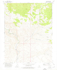
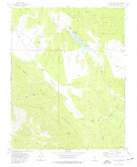
1973 Map of Leith
USGS Topo · Published 1976About this map
Meadow Valley Wash dictates the movement of people and industry through this arid Lincoln County corridor. Parallel to the wash, the Union Pacific railroad tracks connect the small settlements of Kyle and Leith, providing a vital transit link through the basin. This desert landscape is defined by its scarce but essential water sources, including curiously named points like Fountain of Youth Spring, Oil Spring, and Mud Hole Spring. To the east, the terrain rises into complex drainage systems like Cottonwood Canyon and Cougar Canyon. Evidence of early 1970s resource extraction is visible at the Cherokee Mine in the southeastern portion of the quadrangle. A network of jeep trails provides the only access into the high pasture lands and rugged canyons that flank the central valley floor.
Find a feature on this map
19 named features on this map. Tap any name to fly to it.
Don’t see what you’re looking for? This feature index may not catch every label — zoom into the map to look around manually.
Map Details
Editions of this 1973 Leith Map
2 editions found
Other maps of this area

1885 · Pioche
USGS Topo · 1:250,000

1886 · Pioche
USGS Topo · 1:250,000

1954 · Caliente
USGS Topo · 1:250,000

1959 · Caliente
USGS Topo · 1:250,000

1969 · Elgin
USGS Topo · 1:24,000

1969 · Elgin NE
USGS Topo · 1:24,000
1969 · Vigo NE
USGS Topo · 1:24,000

1973 · Ella Mountain
USGS Topo · 1:24,000
1973 · Blue Nose Peak
USGS Topo · 1:24,000
1973 · Fife Mountain
USGS Topo · 1:24,000