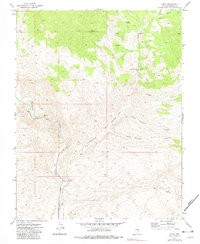
1973 Map of Leith
USGS Topo · Published 1982About this map
Meadow Valley Wash carves a deep path through Lincoln County, serving as the primary corridor for the Union Pacific railroad line. This 1973 survey illustrates the sparse but critical water resources essential for habitation in the high desert, from the evocatively named Fountain of Youth Spring to Oil Spring and Mudhole Spring. The settlement at Leith sits along the rail line at the base of Cottonwood Wash, representing a remote outpost in a landscape defined by steep canyons and named grazing lands like the Horse Pasture.
Find a feature on this map
20 named features on this map. Tap any name to fly to it.
Don’t see what you’re looking for? This feature index may not catch every label — zoom into the map to look around manually.
Map Details
Editions of this 1973 Leith Map
2 editions found
Other maps of this area

1885 · Pioche
USGS Topo · 1:250,000

1886 · Pioche
USGS Topo · 1:250,000

1954 · Caliente
USGS Topo · 1:250,000

1959 · Caliente
USGS Topo · 1:250,000

1969 · Elgin
USGS Topo · 1:24,000

1969 · Elgin NE
USGS Topo · 1:24,000
1969 · Vigo NE
USGS Topo · 1:24,000

1973 · Ella Mountain
USGS Topo · 1:24,000
1973 · Leith
USGS Topo · 1:24,000
1973 · Blue Nose Peak
USGS Topo · 1:24,000