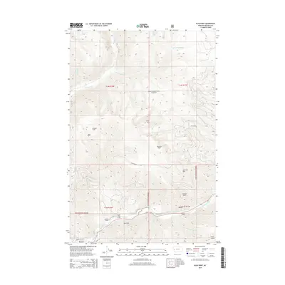
2014 Map of Blue Point
USGS Topo · Published 2014About this map
The Blackfoot River carves through the southern portion of this landscape, a vital corridor defined by the timber and transport history of Bonner and Miller. Within the Lolo National Forest, the terrain rises sharply from the riverbank toward the high peaks of Sheep Mth and the prominent Blue Point. These slopes are etched with numerous drainages, including Rattlesnake Cr, Beeskove Cr, and La Pray Cr. Local landmarks such as the Marco Flat Bridge and Wisherd Bridge provide specific points of reference for tracing historical access across the waterway. To the north, the elevation culminates in the isolated Farmers Lakes, while the western boundary follows the long spine of Wisherd Ridge. The map details a complex network of forest roads and gulches like Johnson Gulch and Heyers Gulch that reflect the area's legacy of mountain navigation.
Find a feature on this map
34 named features on this map. Tap any name to fly to it.
Don’t see what you’re looking for? This feature index may not catch every label — zoom into the map to look around manually.
Map Details
Editions of this 2014 Blue Point Map
This is the sole edition of this map. No revisions or reprints were ever made.
Other maps of this area

1903 · Bonner
USGS Topo · 1:125,000

1921 · Elbow Lake
USGS Topo · 1:125,000

1947 · Butte
USGS Topo · 1:250,000

1955 · Choteau
USGS Topo · 1:250,000

1957 · Choteau
USGS Topo · 1:250,000

1958 · Butte
USGS Topo · 1:250,000

1958 · Choteau
USGS Topo · 1:250,000

1960 · Butte
USGS Topo · 1:250,000

1962 · Choteau
USGS Topo · 1:250,000

1962 · Butte
USGS Topo · 1:250,000