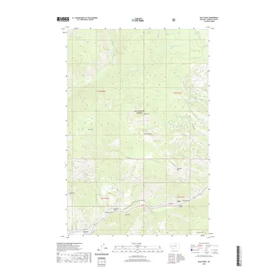
2020 Map of Blue Point
USGS Topo · Published 2020About this map
Lolo National Forest dominates this mountain landscape in western Montana, where high peaks and deep drainages define the topography. The Blackfoot River carves through the southern portion of the sheet, providing a corridor for the settlement of Bonner and the nearby community of Miller. Significant elevation changes are marked by prominent summits like Sheep Mtn and Woody Mtn, while Wisherd Ridge separates the winding Rattlesnake Cr from the W Twin Cr basin. Evidence of timber and resource access is seen in the network of forest roads and trails, including Twin Creek Rd and the Cowboy Trl. Historical infrastructure is preserved through labeled landmarks such as the Marco Flat Bridge and Wisherd Bridge, reflecting the essential river crossings that linked these isolated valley settlements to the broader Missoula County region.
Find a feature on this map
36 named features on this map. Tap any name to fly to it.
Don’t see what you’re looking for? This feature index may not catch every label — zoom into the map to look around manually.
Map Details
Editions of this 2020 Blue Point Map
This is the sole edition of this map. No revisions or reprints were ever made.
Other maps of this area

1903 · Bonner
USGS Topo · 1:125,000

1921 · Elbow Lake
USGS Topo · 1:125,000

1947 · Butte
USGS Topo · 1:250,000

1955 · Choteau
USGS Topo · 1:250,000

1957 · Choteau
USGS Topo · 1:250,000

1958 · Butte
USGS Topo · 1:250,000

1958 · Choteau
USGS Topo · 1:250,000

1960 · Butte
USGS Topo · 1:250,000

1962 · Choteau
USGS Topo · 1:250,000

1962 · Butte
USGS Topo · 1:250,000