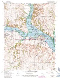
1968 Map of Blue Rapids
USGS Topo · Published 1983About this map
Tuttle Creek Lake dominates the central landscape of this Marshall County survey, where the Big Blue River and Little Blue River converge. The reservoir's reach is defined by a normal pool elevation of 1,075 feet, inundating the valleys between the high ground of Blue Rapids City and Waterville. The railroad infrastructure of the late 1960s and early 1980s is clearly visible, with the Union Pacific and Missouri Pacific lines serving the river towns. Extensive quarrying and numerous gravel pits near the riverbanks point to the local industrial activity of the era.
Find a feature on this map
39 named features on this map. Tap any name to fly to it.
Don’t see what you’re looking for? This feature index may not catch every label — zoom into the map to look around manually.
Map Details
Editions of this 1968 Blue Rapids Map
2 editions found
Other maps of this area

1889 · Marysville
USGS Topo · 1:125,000

1894 · Marysville
USGS Topo · 1:125,000

1955 · Manhattan
USGS Topo · 1:250,000

1956 · Manhattan
USGS Topo · 1:250,000

1957 · Manhattan
USGS Topo · 1:250,000

1966 · Marysville
USGS Topo · 1:24,000

1966 · Hanover SE
USGS Topo · 1:24,000

1966 · Home
USGS Topo · 1:24,000
1968 · Blue Rapids SE
USGS Topo · 1:24,000
1968 · Blue Rapids NE
USGS Topo · 1:24,000