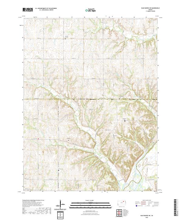
2022 Map of Blue Rapids SW
USGS Topo · Published 2022About this map
Big Blue River meanders through the southeastern corner of this Kansas landscape, where the borders of Marshall, Riley, and Pottawatomie counties converge. The terrain is defined by a dense network of watercourses including Swede Cr, Little Swede Cr, and Game Fork, which carve through the uplands toward the river valley. Significant for genealogical research, the area is home to several well-preserved rural burial grounds, such as Saint Wenceslaus Cem near the northern county line and Bellegarde Cem to the south. The presence of Shannon Creek Res and the prominent Christenson Hill provide clear markers for the local topography. This region maintains a traditional section-line road grid, with routes like Parallel Rd and Center Hill Rd providing access to the various family-named ravines and creek bottoms that have shaped local settlement patterns for generations.
Find a feature on this map
54 named features on this map. Tap any name to fly to it.
Don’t see what you’re looking for? This feature index may not catch every label — zoom into the map to look around manually.
Map Details
Editions of this 2022 Blue Rapids SW Map
This is the sole edition of this map. No revisions or reprints were ever made.
Other maps of this area

1886 · Junction City
USGS Topo · 1:125,000

1889 · Marysville
USGS Topo · 1:125,000

1889 · Junction City
USGS Topo · 1:125,000

1894 · Junction City
USGS Topo · 1:125,000

1894 · Marysville
USGS Topo · 1:125,000

1955 · Manhattan
USGS Topo · 1:250,000

1956 · Manhattan
USGS Topo · 1:250,000

1957 · Manhattan
USGS Topo · 1:250,000
1964 · Randolph
USGS Topo · 1:24,000
1964 · Olsburg
USGS Topo · 1:24,000