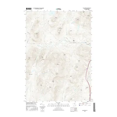
2016 Map of Blue Ridge
USGS Topo · Published 2016About this map
Adirondack Park lands dominate this high-relief area of Essex County, where the settlement of Blue Ridge sits along Co Hwy 28. The landscape is defined by the heavy drainage network of the Schroon River and its numerous tributaries, including The Branch and The Gulf Brook. Notable elevations such as Nippletop Mtn and Hoffman Mtn overlook significant lowlands like Big Marsh and Clear Pond. The survey highlights a complex terrain of named ridges and notches, from the Texas Ridge and Blue Ridge Range to the distinct gap at Hoffman Notch. This documentation captures the character of the New York wilderness in the early 21st century, showing the intersection of forest preserve boundaries with local county routes like Elk Lake Rd and Gulf Brook Rd.
Find a feature on this map
46 named features on this map. Tap any name to fly to it.
Don’t see what you’re looking for? This feature index may not catch every label — zoom into the map to look around manually.
Map Details
Editions of this 2016 Blue Ridge Map
This is the sole edition of this map. No revisions or reprints were ever made.
Other maps of this area

1894 · Elizabethtown
USGS Topo · 1:62,500

1895 · Elizabethtown
USGS Topo · 1:62,500

1895 · Mt. Marcy
USGS Topo · 1:62,500

1895 · Paradox Lake
USGS Topo · 1:62,500

1897 · Paradox Lake
USGS Topo · 1:62,500

1897 · Schroon Lake
USGS Topo · 1:62,500

1901 · Elizabethtown
USGS Topo · 1:62,500

1902 · Mt. Marcy
USGS Topo · 1:62,500

1950 · Glens Falls
USGS Topo · 1:250,000

1950 · Lake Champlain
USGS Topo · 1:250,000