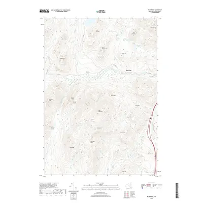
2019 Map of Blue Ridge
USGS Topo · Published 2019About this map
The Schroon River valley defines the eastern edge of this Adirondack landscape, where the settlement of Blue Ridge sits along Co HWY 28. The topography is dominated by significant elevations including the Blue Ridge Range, Hoffman Mtn, and Nippletop Mtn. Water features such as Clear Pond and Big Marsh are tucked between these high ridges, feeding a network of streams like The Branch and Niagara Brook. The layout of forest roads like Elk Lake RD and Gulf Brook RD suggests a region defined by its timber and wilderness access rather than dense residential development. Named peaks and ridges, including Texas Ridge and Wyman Hill, provide specific landmarks for those tracing the geographic history of Essex County.
Find a feature on this map
45 named features on this map. Tap any name to fly to it.
Don’t see what you’re looking for? This feature index may not catch every label — zoom into the map to look around manually.
Map Details
Editions of this 2019 Blue Ridge Map
This is the sole edition of this map. No revisions or reprints were ever made.
Other maps of this area

1894 · Elizabethtown
USGS Topo · 1:62,500

1895 · Elizabethtown
USGS Topo · 1:62,500

1895 · Mt. Marcy
USGS Topo · 1:62,500

1895 · Paradox Lake
USGS Topo · 1:62,500

1897 · Paradox Lake
USGS Topo · 1:62,500

1897 · Schroon Lake
USGS Topo · 1:62,500

1901 · Elizabethtown
USGS Topo · 1:62,500

1902 · Mt. Marcy
USGS Topo · 1:62,500

1950 · Glens Falls
USGS Topo · 1:250,000

1950 · Lake Champlain
USGS Topo · 1:250,000