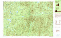
1989 Map of Blue Ridge
USGS Topo · Published 1989About this map
The Adirondack Park highlands of Essex County are defined by a complex network of glacial ponds and mountain ridges as they appeared in the late 1980s. The landscape is dominated by the Blue Ridge Range and Washburn Ridge, which channel drainage into the Boreas River and several tributary systems including Wolf Pond Brook. This area, divided among the townships of Newcomb, North Hudson, Minerva, and Schroon, shows a terrain largely devoid of heavy development, instead featuring remote landmarks like a Foot Bridge and the high elevations of Nippletop Mtn. Local topography is punctuated by distinctive gaps such as Hoffman Notch and Hornet Notch, which have historically dictated the passage of trails and water through these summits. Numerous bodies of water, from Sand Pond to the secluded Vanderwhacker Pond, provide clear reference points for those studying the hydrological patterns of the High Peaks region.
Find a feature on this map
66 named features on this map. Tap any name to fly to it.
Don’t see what you’re looking for? This feature index may not catch every label — zoom into the map to look around manually.
Map Details
Editions of this 1989 Blue Ridge Map
This is the sole edition of this map. No revisions or reprints were ever made.
Other maps of this area

1894 · Elizabethtown
USGS Topo · 1:62,500

1895 · Elizabethtown
USGS Topo · 1:62,500

1895 · Mt. Marcy
USGS Topo · 1:62,500

1895 · Paradox Lake
USGS Topo · 1:62,500

1897 · Paradox Lake
USGS Topo · 1:62,500

1897 · Schroon Lake
USGS Topo · 1:62,500

1898 · Newcomb
USGS Topo · 1:62,500

1901 · Newcomb
USGS Topo · 1:62,500

1901 · Elizabethtown
USGS Topo · 1:62,500

1902 · Mt. Marcy
USGS Topo · 1:62,500