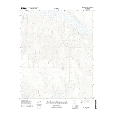
2016 Map of Blue Ridge School
USGS Topo · Published 2016About this map
Blue Ridge School stands as a focal point in this 2016 survey of Hemphill County, Texas, marking a landscape where the high plains break toward the Canadian River valley. The map documents a complex drainage network where Needmore Cr, Turkey Cr, and Big Timber Creek flow northward into the river's broad, sandy bed. To the south, the topography shifts toward the headwaters of the Dry Fork Washita River, illustrating the divide between these two significant Texas watersheds.
Find a feature on this map
25 named features on this map. Tap any name to fly to it.
Don’t see what you’re looking for? This feature index may not catch every label — zoom into the map to look around manually.
Map Details
Editions of this 2016 Blue Ridge School Map
This is the sole edition of this map. No revisions or reprints were ever made.
Other maps of this area

1954 · Amarillo
USGS Topo · 1:250,000

1958 · Amarillo
USGS Topo · 1:250,000

1967 · Dads Creek
USGS Topo · 1:24,000

1967 · Gem
USGS Topo · 1:24,000

1967 · Hackberry Creek
USGS Topo · 1:24,000

1967 · Lake June
USGS Topo · 1:24,000

1967 · Blue Ridge School
USGS Topo · 1:24,000

1967 · Canadian SE
USGS Topo · 1:24,000

1972 · Canadian East
USGS Topo · 1:24,000
1972 · Lake Marvin
USGS Topo · 1:24,000