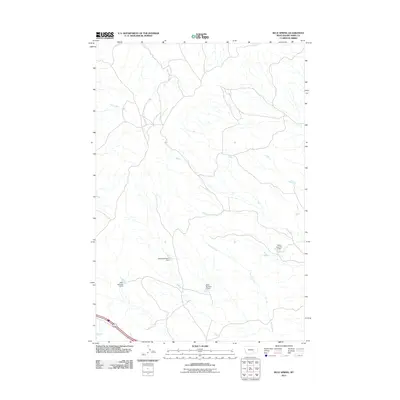
2011 Map of Blue Spring
USGS Topo · Published 2011About this map
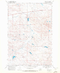
Blue Spring and a series of water management structures characterize this sparsely populated stretch of Big Horn County during the early twenty-first century. The landscape is defined by the winding paths of Peritsa Creek, Lost Boy Creek, and Deer Creek, which drain the open range of southern Montana. This specific era shows a developed network of small-scale dams and reservoirs, likely serving local ranching or agricultural needs, including the Atkins Number 2 Dam and several labeled for the Ottun family, such as Ottun Number 5 Dam, Ottun Number 6 Dam, and Ottun Number 8 Dam. These family-named landmarks provide a record of local land use and infrastructure in a region where water sources are vital to the community.
Find a feature on this map
8 named features on this map. Tap any name to fly to it.
Don’t see what you’re looking for? This feature index may not catch every label — zoom into the map to look around manually.
Map Details
Editions of this 2011 Blue Spring Map
This is the sole edition of this map. No revisions or reprints were ever made.
Other maps of this area

1894 · Fort Custer
USGS Topo · 1:125,000

1954 · Hardin
USGS Topo · 1:250,000

1957 · Hardin
USGS Topo · 1:250,000

1958 · Hardin
USGS Topo · 1:250,000

1960 · Chimney Creek
USGS Topo · 1:24,000

1960 · Walker Hill
USGS Topo · 1:24,000
1960 · Lemon Ranch
USGS Topo · 1:24,000
1967 · Wagon Box Spring
USGS Topo · 1:24,000
1967 · Pompeys Pillar
USGS Topo · 1:24,000
1969 · Rowley NW
USGS Topo · 1:24,000