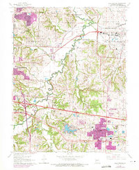
1965 Map of Blue Springs
USGS Topo · Published 1971About this map
The Little Blue River meanders through the heart of Jackson County in the mid-1960s, a period when the eastern edge of Independence was expanding toward the rolling hills of Sni-A-Bar. This landscape is defined by the heavy industrial presence of the Lake City Army Ammunition Plant in the northeast and the recreational waters of Lake Tapawingo to the south. Local community life is rooted in a network of country schools and churches, including De Kelly Sch, Spring Branch Sch, and Lobb Cumberland Ch. The map highlights the transition from rural Missouri farms to suburban development, with purple revision tints marking urban extensions around Blue Springs and East Independence. Researchers will find significant genealogical data in the locations of Oak Ridge Memory Gardens, Lobb Cem, and Stanley Cem.
Find a feature on this map
42 named features on this map. Tap any name to fly to it.
Don’t see what you’re looking for? This feature index may not catch every label — zoom into the map to look around manually.
Map Details
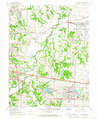
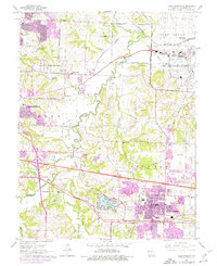
Editions of this 1965 Blue Springs Map
3 editions found
Other maps of this area

1887 · Harrisonville
USGS Topo · 1:125,000

1892 · Harrisonville
USGS Topo · 1:125,000

1894 · Harrisonville
USGS Topo · 1:125,000

1894 · Independence
USGS Topo · 1:125,000

1933 · Blue Springs
USGS Topo · 1:24,000

1934 · Oak Grove
USGS Topo · 1:24,000

1934 · Independence
USGS Topo · 1:24,000

1934 · Lees Summit
USGS Topo · 1:24,000

1934 · Woods Chapel
USGS Topo · 1:24,000

1935 · Buckner
USGS Topo · 1:24,000