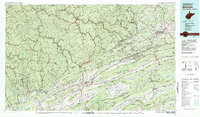
1981 Map of Bluefield
USGS Topo · Published 1981About this map
Bluefield and the surrounding coalfields of West Virginia and Virginia are shown at a peak of industrial and regional connectivity. The landscape is defined by the sharp, linear ridges of the Appalachian Mountains, including Rich Mountain and East River Mountain, which separate the deep mining valleys of McDowell County from the agricultural valleys of Tazewell County. The complex rail network of the Norfolk and Western RR winds through tight corridors to serve coal-producing centers like Welch, Gary, and the historic mining town of Pocahontas. Notable cultural and educational anchors like Southwest Virginia Community College and Bluefield College sit alongside large-scale transportation infrastructure like Interstate 77. The unique geological bowl of Burkes Garden stands out as a distinct high-elevation valley, while public lands like Panther State Forest and Jefferson National Forest cover the most prominent ridges.
Find a feature on this map
120 named features on this map. Tap any name to fly to it.
Don’t see what you’re looking for? This feature index may not catch every label — zoom into the map to look around manually.
Map Details
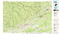
Editions of this 1981 Bluefield Map
2 editions found
Other maps of this area

1886 · Grundy
USGS Topo · 1:125,000

1887 · Warfield
USGS Topo · 1:125,000

1887 · Pocahontas
USGS Topo · 1:125,000

1887 · Hinton
USGS Topo · 1:125,000

1889 · Hillsville
USGS Topo · 1:125,000

1889 · Wytheville
USGS Topo · 1:125,000

1890 · Grundy
USGS Topo · 1:125,000

1890 · Dublin
USGS Topo · 1:125,000

1891 · Tazewell
USGS Topo · 1:125,000

1891 · Pocahontas
USGS Topo · 1:125,000