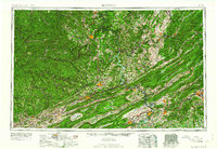
1961 Map of Bluefield
USGS Topo · Published 1961About this map
Bluefield and the coal-country towns of the Appalachians are depicted here as they appeared in the early 1960s. The landscape is defined by the sharp ridges of the Allegheny Mountains and the Blue Ridge, which forced the development of towns like Welch and Mullens into narrow river valleys. A complex network of heavy rail infrastructure, including the Norfolk and Western Ry and the Virginian Ry, connects the mining districts to the outside world. This survey also records a significant era of hydraulic change, showing the Bluestone Reservoir and Claytor Lake along the New River system. The map serves as a vital record for researchers tracing the industrial footprint of the Raleigh Co and Giles Co borders before the expansion of the modern interstate system, highlighting the prominence of older routes like U.S. 460 and U.S. 11.
Find a feature on this map
65 named features on this map. Tap any name to fly to it.
Don’t see what you’re looking for? This feature index may not catch every label — zoom into the map to look around manually.
Map Details
Editions of this 1961 Bluefield Map
This is the sole edition of this map. No revisions or reprints were ever made.
Other maps of this area

1886 · Grundy
USGS Topo · 1:125,000

1887 · Warfield
USGS Topo · 1:125,000

1887 · Pocahontas
USGS Topo · 1:125,000

1887 · Hinton
USGS Topo · 1:125,000

1887 · Lewisburg
USGS Topo · 1:125,000

1889 · Nicholas
USGS Topo · 1:125,000

1889 · Hillsville
USGS Topo · 1:125,000

1889 · Wytheville
USGS Topo · 1:125,000

1890 · Roanoke
USGS Topo · 1:125,000

1890 · Grundy
USGS Topo · 1:125,000