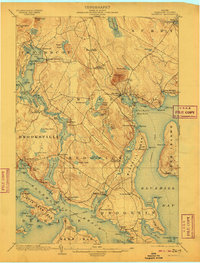
1904 Map of Bluehill
USGS Topo · Published 1909About this map
Bluehill stands as a central coastal hub in this early twentieth-century survey of Hancock County, where the maritime economy is clearly etched into the shoreline. The topography is dominated by the prominent rise of Blue Hill and Montgomery Mt., while the complex coastline is punctuated by numerous points and coves like Hatchings Cove and Grindle Pt.. This map provides a detailed look at the maritime infrastructure of the era, specifically marking the Steamboat Route weaving through Eggemoggin Reach and into Bluehill Harbor.
Find a feature on this map
113 named features on this map. Tap any name to fly to it.
Don’t see what you’re looking for? This feature index may not catch every label — zoom into the map to look around manually.
Map Details
Editions of this 1904 Bluehill Map
5 editions found
Other maps of this area

1900 · Orland
USGS Topo · 1:62,500

1900 · Bucksport
USGS Topo · 1:62,500

1902 · Bucksport
USGS Topo · 1:62,500

1902 · Castine
USGS Topo · 1:62,500

1904 · Deer Isle
USGS Topo · 1:62,500

1904 · Castine
USGS Topo · 1:62,500

1904 · Mount Desert
USGS Topo · 1:62,500

1904 · Swan Island
USGS Topo · 1:62,500

1904 · Bluehill
USGS Topo · 1:62,500

1904 · Vinalhaven
USGS Topo · 1:62,500