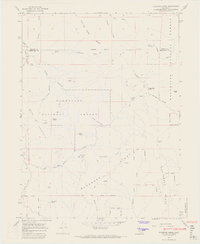
1967 Map of Bluenose Ridge
USGS Topo · Published 1969About this map
Round Valley Indian Reservation lands and the high timber of the Mendocino National Forest meet in this 1960s survey. The landscape is defined by its legal and historical demarcations, notably the Old Indian Treaty Boundary and the Trinity Co Mendocino Co line, which cut through the drainage basins of Casoose Creek and Lightning Camp Creek. The area retains a character of seasonal labor and ranching, evidenced by Lightning Camp, Brown Ranch, and the isolated Salt Rock Camp.
Find a feature on this map
43 named features on this map. Tap any name to fly to it.
Don’t see what you’re looking for? This feature index may not catch every label — zoom into the map to look around manually.
Map Details
Editions of this 1967 Bluenose Ridge Map
4 editions found
Other maps of this area

1920 · Covelo
USGS Topo · 1:62,500

1921 · Hoaglin
USGS Topo · 1:62,500

1922 · Island Mountain
USGS Topo · 1:62,500

1926 · Covelo
USGS Topo · 1:62,500

1931 · Hoaglin
USGS Topo · 1:96,000

1935 · Hoaglin
USGS Topo · 1:125,000

1952 · Spyrock
USGS Topo · 1:62,500

1952 · Covelo
USGS Topo · 1:62,500

1953 · Blackrock Mtn
USGS Topo · 1:62,500

1954 · Blackrock Mtn
USGS Topo · 1:62,500