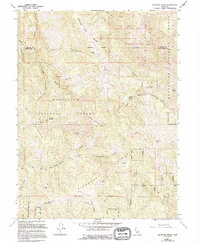
1967 Map of Bluenose Ridge
USGS Topo · Published 1994About this map
The Mendocino National Forest defines this high-elevation landscape, where the Trinity County and Mendocino County border meets the Yolla Bolly Middle Eel Wilderness. A network of 4WD tracks navigates the steep grades between Hulls Mountain and Castle Peak, connecting seasonal outposts and family-named landmarks. The presence of the Old Indian Treaty Boundary and the Round Valley Indian Res Bdy reflects the complex land division of this region. Notable former activity centers include Lightning Camp (Site) and Salt Rock Camp (Site), along with the Brown Ranch. The terrain is deeply incised by drainages like Pepperwood Creek and Casnoose Creek, while prominent points like Little Baldy and the spine of Asa Bean Ridge provide orientation across the heavily timbered ridgelines.
Find a feature on this map
33 named features on this map. Tap any name to fly to it.
Don’t see what you’re looking for? This feature index may not catch every label — zoom into the map to look around manually.
Map Details
Editions of this 1967 Bluenose Ridge Map
4 editions found
Other maps of this area

1920 · Covelo
USGS Topo · 1:62,500

1921 · Hoaglin
USGS Topo · 1:62,500

1922 · Island Mountain
USGS Topo · 1:62,500

1926 · Covelo
USGS Topo · 1:62,500

1931 · Hoaglin
USGS Topo · 1:96,000

1935 · Hoaglin
USGS Topo · 1:125,000

1952 · Spyrock
USGS Topo · 1:62,500

1952 · Covelo
USGS Topo · 1:62,500

1953 · Blackrock Mtn
USGS Topo · 1:62,500

1954 · Blackrock Mtn
USGS Topo · 1:62,500