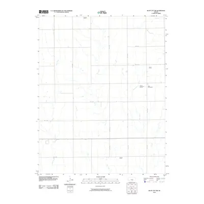
2010 Map of Bluff City NW
USGS Topo · Published 2010About this map
The energy-driven landscape of Harper County is prominently displayed here through the presence of several petroleum extraction sites, including the Freeport Oil Field and the Freeport South Oil and Gas Field. These industrial features are set against a backdrop of traditional Kansas section lines and drainage systems. The northern portion of the map is defined by the headwaters of Rock Creek and Sand Creek, while the central and southern reaches are carved by the winding paths of Silver Creek and Baehr Creek. Aviation infrastructure serves the local community via the Kaypod Airport in the north and the Salser Landing Strip near the eastern margin. Further south, the Stohrville Oil Field continues the theme of sub-surface resource development that characterizes this rural agricultural and industrial area.
Find a feature on this map
22 named features on this map. Tap any name to fly to it.
Don’t see what you’re looking for? This feature index may not catch every label — zoom into the map to look around manually.
Map Details
Editions of this 2010 Bluff City NW Map
This is the sole edition of this map. No revisions or reprints were ever made.
Other maps of this area

1889 · Anthony
USGS Topo · 1:125,000

1889 · Caldwell
USGS Topo · 1:125,000

1891 · Anthony
USGS Topo · 1:125,000

1893 · Caldwell
USGS Topo · 1:125,000

1897 · Caldwell
USGS Topo · 1:125,000

1955 · Wichita
USGS Topo · 1:250,000

1955 · Pratt
USGS Topo · 1:250,000

1958 · Wichita
USGS Topo · 1:250,000

1959 · Pratt
USGS Topo · 1:250,000
1971 · Bluff City West
USGS Topo · 1:24,000