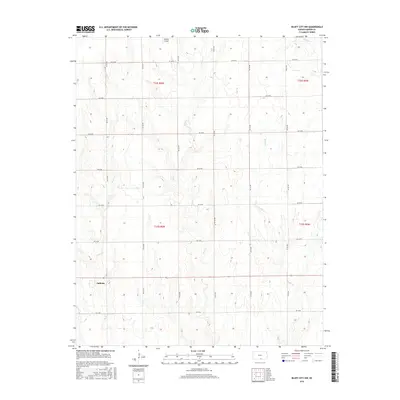
2015 Map of Bluff City NW
USGS Topo · Published 2015About this map
Anthony occupies the southwestern corner of this survey, situated within a highly structured landscape of Section-line roads. This portion of Harper County is defined by its agrarian grid, where arterial routes like Berlin Rd and NE 70 Ave navigate a terrain shaped by gentle drainage patterns. The hydrology of the region is dominated by several winding waterways, including Rock Creek, Silver Creek, and Baehr Creek, which cut across the surveyed townships. On the northern edge of this territory, the Kaypod Airport serves as a lone modern landmark within the broad expanse of rural Kansas acreage. The map provides a clear record of the mid-2010s infrastructure, documenting the exact placement of local roads from NE 10 Rd to NE 60 Rd and their relationship to the historical township and range system.
Find a feature on this map
28 named features on this map. Tap any name to fly to it.
Don’t see what you’re looking for? This feature index may not catch every label — zoom into the map to look around manually.
Map Details
Editions of this 2015 Bluff City NW Map
This is the sole edition of this map. No revisions or reprints were ever made.
Other maps of this area

1889 · Anthony
USGS Topo · 1:125,000

1889 · Caldwell
USGS Topo · 1:125,000

1891 · Anthony
USGS Topo · 1:125,000

1893 · Caldwell
USGS Topo · 1:125,000

1897 · Caldwell
USGS Topo · 1:125,000

1955 · Wichita
USGS Topo · 1:250,000

1955 · Pratt
USGS Topo · 1:250,000

1958 · Wichita
USGS Topo · 1:250,000

1959 · Pratt
USGS Topo · 1:250,000
1971 · Bluff City West
USGS Topo · 1:24,000