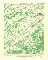
1935 Map of Bluff City
USGS Topo · Published 1935About this map
Bluff City sits at the convergence of the Southern railroad and the South Fork Holston River, serving as a central hub in this 1935 industrial and agricultural landscape. The region is defined by a dense network of water-powered infrastructure, featuring numerous sites like Greys Mill, Shaver Mill, and Galloway Mill. Further south, the Andrew Johnson Highway facilitates travel through Piney Flats, where the Piney Flats Electric Co indicates the era's advancing electrification.
Find a feature on this map
86 named features on this map. Tap any name to fly to it.
Don’t see what you’re looking for? This feature index may not catch every label — zoom into the map to look around manually.
Map Details
Editions of this 1935 Bluff City Map
2 editions found
Other maps of this area

1891 · Roan Mountain
USGS Topo · 1:125,000

1894 · Roan Mountain
USGS Topo · 1:125,000

1897 · Bristol
USGS Topo · 1:125,000

1902 · Bristol
USGS Topo · 1:125,000

1904 · Roan Mountain
USGS Topo · 1:125,000

1934 · Bristol
USGS Topo · 1:24,000

1935 · Watauga Valley
USGS Topo · 1:48,000

1935 · Blountville
USGS Topo · 1:24,000
1935 · Beaver Creek
USGS Topo · 1:48,000

1935 · Spurgeon
USGS Topo · 1:24,000